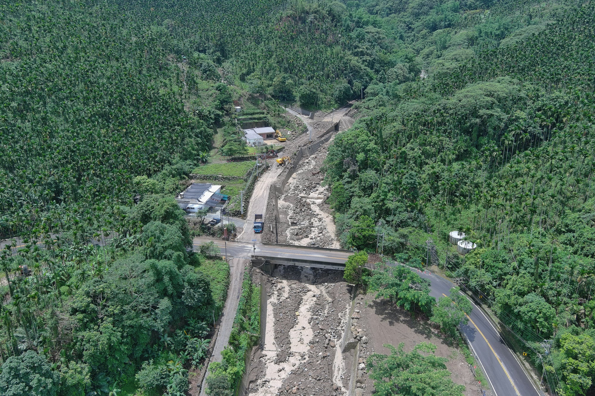
In September 2025, continuous heavy rain brought by Super Typhoon Ragasa triggered catastrophic landslides across eastern Taiwan. In Hualien County, the collapse of the Matai’an barrier lake unleashed millions of tons of water and debris, sweeping through Guangfu Township within minutes.
The government issued more than 70 red alerts for potential landslides across the island that week, from Yilan to New Taipei. Experts warned that the danger wasn’t over: many weakened slopes could still fail after subsequent rain.
Insight from the Soil & Water Conservation Bureau
The Soil & Water Conservation Bureau (水土保持署) has long studied post-disaster recovery and risk management.
In its e-paper, 《震後堰塞湖的形成與災害風險緊急評估》, the Bureau explains how landslide-dammed lakes often form after earthquakes or prolonged rainfall. These lakes can appear stable at first — but when the natural dam erodes or breaches, the resulting flood can be catastrophic.
▶️E-paper link in Chinese https://tech.ardswc.gov.tw/EPaper/Home/EPaper?PaperID=92b03e44-2a5a-467e-8c80-989e7e37cd06
The paper emphasizes three key needs:
-
Continuous observation of potential landslides and dammed lake zones.
-
Rapid data collection for emergency risk evaluation.
-
Long-term visual documentation to support geological research and prevention planning.
Such principles align perfectly with what time lapse monitoring can offer — non-intrusive, continuous, visual tracking of terrain evolution.
The Unseen Slow Motion Before Disaster
Every landslide tells a story in slow motion. Before the final collapse, small warning signs often appear:


Brinno Successful Story in the past
Time lapse cameras may not provide real-time alerts at the very moment an accident occurs, but they are among the most valuable research tools for understanding the causes behind such disasters. Through long-term visual recording, time lapse footage allows experts to review, analyze, and reconstruct the gradual changes that led to an event.
In some of our previous articles, we demonstrated how time lapse technology can compress vast amounts of visual data into a single, easy-to-analyze video, helping researchers and agencies better witness and learn from the evolution of each incident.
How Time Lapse Technology Can Help
A professional time lapse camera system, especially one built for long-term outdoor monitoring, can transform how environmental bureaus, local governments, and research institutes monitor slope safety.
Key Benefits:
-
📸 24/7 Visual Records: Capture continuous imagery over months or years in remote mountain zones.
-
🌦️ Weatherproof and Battery Powered: Operate autonomously even in harsh rain or storms.
-
🌐 Remote Access and Alerts: Allow teams to monitor from headquarters and reduce the need for on-site inspection in risky terrain.
-
⏱️ Instant Time Lapse Video: Condense months of visual data into seconds, revealing hidden patterns of erosion, movement, or sediment buildup.
-
📊 Support for Data Integration: Combine visual evidence with rainfall and hydrological sensor data for stronger risk modeling.
With these tools, bureaus can better forecast slope instability, document post-disaster recovery, and educate the public about environmental safety.