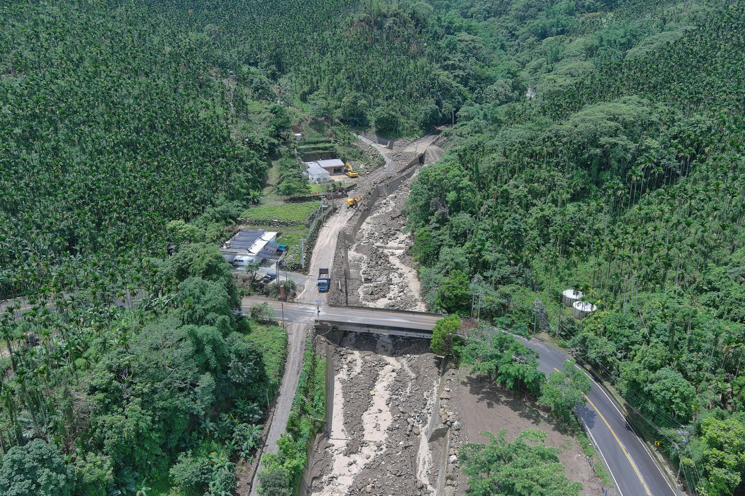
With increasingly extreme weather conditions, local government precautions are receiving greater attention. Accidents caused by sudden rainfall, along with the rising frequency and scale of sediment-related disasters, pose serious threats to both mountain communities and downstream infrastructure.
This time, we met with officials from the Agency of Rural Development and Soil and Water Conservation. One of their recent reports highlights how they are utilizing time lapse photography to capture dynamic changes in streamflow and sediment movement during disaster events.
▶️Read more about this research in Traditional Chinese LINK
1. Tell us about your organization.
Our bureau is responsible for soil and water conservation, rural regeneration, hillside supervision and management, and debris flow warning issuance in Taiwan. We oversee key initiatives such as comprehensive disaster prevention in mountainous areas, large-scale landslide and unstable sediment disaster mitigation under climate change, emergency improvement of agricultural road facilities outside rezoning areas, integrated watershed management, and the Rural Regeneration Fund.

2. Research and technology development platform main daily life?
Another key mission is disaster prevention, which heavily relies on data collection and pattern analysis to improve forecasting accuracy. Whenever an incident occurs, we conduct on-site investigations as long as weather conditions permit. During these visits, we deploy a monitoring vehicle equipped with an antenna to transmit real-time data back to our central system while also capturing photos and videos to document ongoing changes.

3. What is the beginning of applying a time lapse camera to your work?
In the past, potential debris flow watershed areas often lacked detailed records of rainfall and sediment transport dynamics during disaster events, making it difficult to analyze the spatial and temporal evolution of sediment-related disasters following typhoons or earthquakes. Traditional data analysis and field survey methods have limitations in capturing the dynamic processes of disasters. So we decided to use a time lapse camera to capture the visual data of the gradual evaluation, aiming to understand the triggering mechanism of a dangerous event and how it evolved, perhaps overlooking information that wasn't catching anybody’s attention.
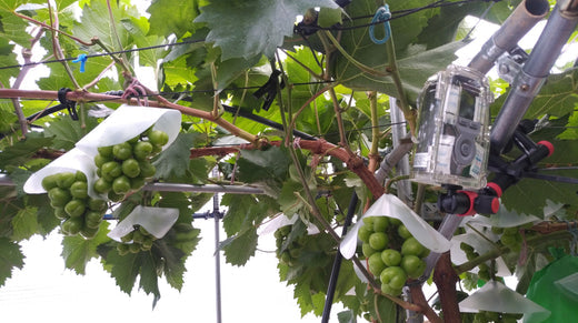
4. Which time lapse camera did you apply and how did you set up everything?
We use a BCC300M and put it somewhere above the bed of the river. The continuation of the recording resulted in over 10 days of recording and the collected data demonstrates the values of exactly what we need them for. When comparing the recorded video to the rainfall numbers, we realized the width of the stream river expanded as the rainfall became heavier; while the substance came along with the streaming differs according to accumulated precipitation instead of the rainfall at the moment. With all the observations above, we can identify the critical conditions of rainfall-runoff and sediment movement within the watershed.

5. What is the conclusion of this case?
Other than the minor error that causes less collected data than originally planned, the reliance of the time lapse camera gives great confidence in tracking the movement of the mother nurture. We’ve even purchased more cameras right after all these reports. In the longer future, we are expected to deploy multiple time lapse cameras to expand the upstream and downstream observation range and could further enhance comprehensive monitoring of sediment-related disasters.